Scientists wary of changed weather pattern in mountains of U’khand

Friday, 14 May 2021 | Vinod Chamoli | New Tehri
The incidents of heavy rains witnessed in the mountainous regions during the month of May have baffled the scientists and caused anxiety among the locals.
Experts say that a cyclonic circulation in the Bay of Bengal, Arabian Sea near the Gujarat coast and the active Western Disturbance have changed the weather pattern in the mountainous region recently. Climate change is also being considered as a major reason for the rise in natural disasters in the month of May this year.
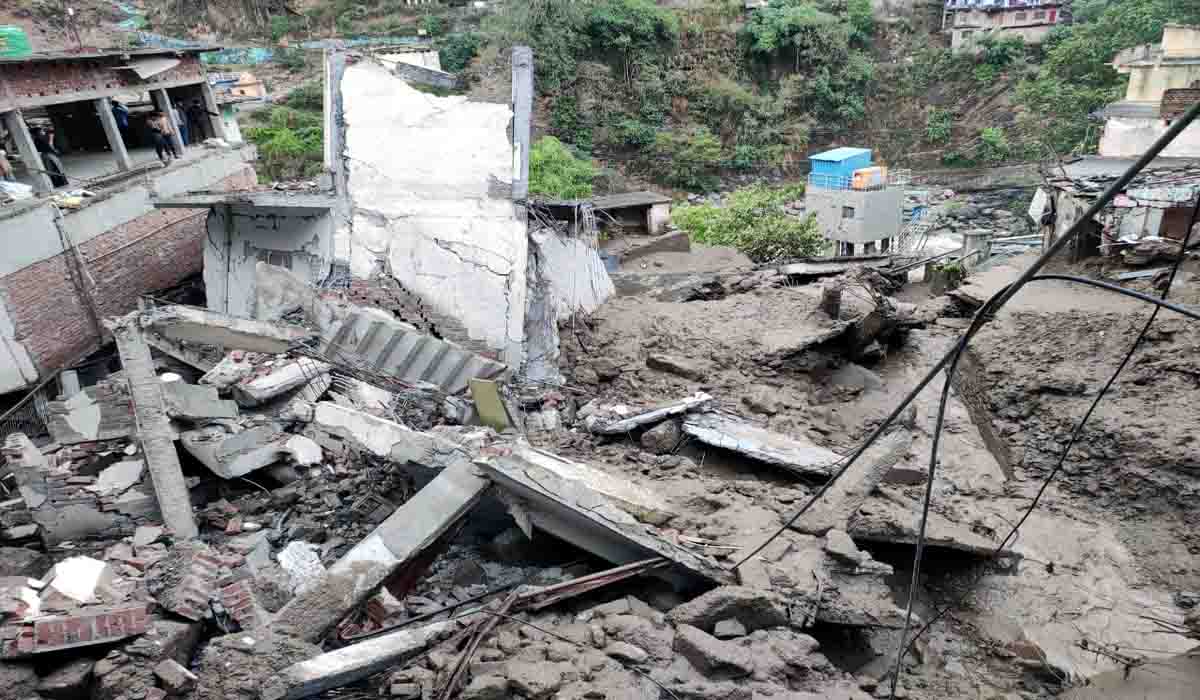
The mercury level has dropped considerably with the residents forced to take out their woolen clothes which were a regular part of daily life only in winters. The incidence of extreme rainfall and cloudburst in the mountains has increased, making people restless. Such incidents have been experienced in Uttarkashi, Chamoli, Rudraprayag and Tehri districts this month. The change in weather is such that it remains clear in the morning and by evening one hears about cloudburst in some area of Garhwal resulting in damage to property. On May 4, five residential buildings were damaged due to cloudburst near Ghat Bazaar in Chamoli district. After that on May 6, a cloudburst in Pipola village in Tehri district damaged many farms. More recently, on May 11, five shops and ITI buildings were severely damaged due to cloudburst in Devprayag area of Tehri district. Similar incidents were also reported in Rudraprayag and Uttarkashi districts. In such a situation, there is a question in people’s minds about the reason for incidents of excess rainfall occurring before the start of monsoon season. In fact, in May this year, the moisture-laden winds are coming from the Bay of Bengal and the Arabian Sea in the mountainous regions.
According to GB Pant Agricultural University meteorologist professor RK Singh, due to the active western disturbance, the mountainous regions of the state are receiving pre-monsoon rains. The western disturbance remains active till the end of April. With this, cyclonic circulation along the Bay of Bengal and the Gujarat coast of the Arabian Sea is accompanied by moisture-laden winds coming northwards. At a time when the moisture-rich clouds are gathering at a high altitude in the mountains, due to the cooling of the temperature, the excess moisture of the air is turning into water and literally pouring down.
Assistant professor at HNB Garhwal University Physics Department, Alok Sagar Gautam said that due to climate change and changes in the local weather, frequent rains are happening especially in the mountainous areas. This month, the wind speed is high and the earth’s surface temperature is high, causing the formation of cumulonimbus clouds and these clouds are moving in with water. Winds moving from east to west bring more rainfall in northwest India through the Bay of Bengal. Gautam also said that the state lacks proper equipment to accurately measure the rainfall in case of heavy rains or cloudburst.


