
PIONEER NEWS SERVICE/Dehradun
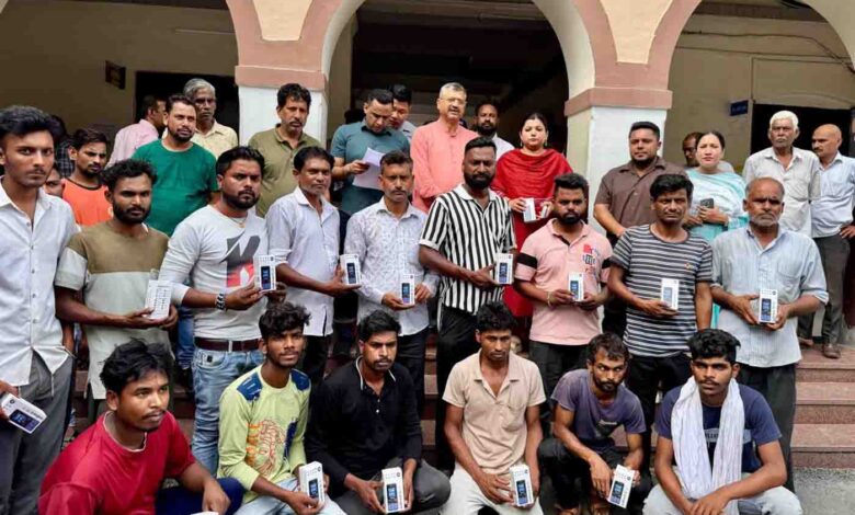
The Municipal Corporation of Dehradun (MCD) will provide mobile phones with each door-to-door waste collection vehicle to enable direct communication and better coordination of drivers with citizens, ward councillors and officials. In the first phase, the corporation distributed 40 mobile phones on Tuesday. This step will strengthen the communication system for timely complaint resolution regarding garbage collection service and reduce the gap between the public and the municipal service units, Dehradun mayor Saurabh Thapliyal said.
The mayor along with Dehradun municipal commissioner Namami Bansal distributed mobile phones to drivers of waste collection vehicles as part of an initiative to make the door-to-door waste collection system more responsive and technically equipped. Bansal informed that under this initiative, each collection vehicle will receive one mobile phone and the entire cost of mobile phones will be covered by MCD.
She said that in the first phase, 40 phones were distributed that covers vehicles from 25 wards and a total of 234 phones will be distributed in the coming phases to cover all 100 wards under the corporation. The corporation aims to continue adopting such measures to strengthen its waste management system and improve coordination with citizens, Bansal added.